Image
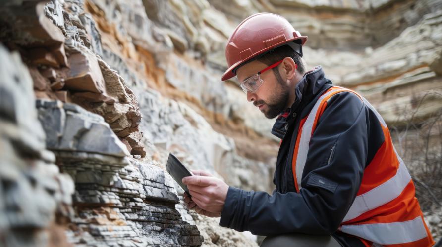
Geology has long been a field rooted in exploration and discovery. Traditionally, geologists spent long hours outdoors, mapping landscapes by hand and studying rock formations up close. These hands-on skills remain at the forefront of any geology career, but today’s geoscientists also rely heavily on new technologies that transform how data is gathered, analyzed, and shared.
From sophisticated computer modeling and drones to satellite image processing and coding, technology plays a crucial role at every stage of geological work. These tools not only improve accuracy but also open new possibilities for understanding the Earth’s complex systems.
Geographic Information Systems, or GIS, have become indispensable in geosciences. Unlike traditional hand-drawn maps, GIS allows geologists to collect, integrate, and analyze vast amounts of spatial data from multiple sources. This can include satellite images, topographic maps, soil surveys, groundwater measurements, and detailed field observations.
GIS is not simply about mapping locations. It enables geologists to detect patterns and relationships, generate predictions, and communicate complex findings clearly. For example, hydrogeologists use GIS to map how groundwater flows through porous media. Environmental geologists analyze how contaminants spread in soil and water, while mining companies rely on GIS to identify mineral deposits. Specialists in natural hazards use it to assess risks from earthquakes, landslides, and floods.
Arindam Mukherjee, hydrogeologist and assistant professor of instruction at Ohio University's College of Arts and Sciences, describes GIS as an essential tool for virtually every geology career.
“It does not matter if you are mapping groundwater contamination, analyzing land-use changes, or exploring oil reserves. GIS provides a platform to stack vast amounts of data from different sources,” Mukherjee said. “Software such as ArcGIS Pro is widely used in the industry. Building strong GIS skills and earning a GIS certificate can make geologists significantly more competitive in the job market.”
GIS also enables the combination of data across different locations and times to create detailed, dynamic maps and models. Governments and companies use these insights to plan infrastructure projects, conserve natural resources, manage water supplies, and respond to natural disasters. The versatility and impact of GIS make it one of the most valuable technical skills in geosciences today.
Remote sensing techniques allow geologists to study areas that are difficult or unsafe to access in person. Data collected from satellites, airplanes, and increasingly drones provides detailed views of large and remote landscapes.
Vincent Nowaczewski, assistant professor of instruction in Ohio University's Earth & Environmental Geoscinces Department and geologist with experience in the domestic energy sector, highlights the growing importance of drones in remote sensing.
“A drone can capture high-resolution images of cliffs or steep outcrops that would take days to climb and involve significant safety risks,” he said.
He explained that drones enable researchers to generate centimeter-scale elevation models and monitor changes in a landscape over time.
“Combining drone imagery with satellite data gives multiple layers of information about land cover, rock formations, and groundwater changes,” Nowaczewski said. “This approach is especially useful for tracking erosion, landslides, or shifts in river paths.”
Remote sensing is also increasingly applied in paleontology, where drones help map fossil sites and document excavation progress with precise, digital records.
Software like ERDAS Imagine and ENVI is critical for processing large amounts of satellite and aerial imagery. When these data are integrated with GIS and coding tools, geologists can build complex 3D models that provide a comprehensive understanding of surface and subsurface conditions.
By combining traditional fieldwork with modern remote sensing, geologists improve the safety and accuracy of their studies. These technologies continue to push the boundaries of what can be observed and understood, supporting better decisions in environmental monitoring, resource management, and hazard assessment.
Understanding Earth’s surface changes over millions of years reveals how continents drift, mountains rise, and oceans form. This knowledge informs research on earthquakes, climate shifts and natural resources.
Plate tectonic reconstructions integrate data such as rock magnetism, fossil distribution and structural mapping. Modern digital tools synthesize these clues into dynamic models that track plate movements and their geological effects through time.

“Programs like GPlates use paleomagnetic data (information about ancient magnetic fields recorded in rocks), seismic surveys, radiometric dating (measuring radioactive decay to determine rock ages) and other data to create reconstructions that are grounded in physical measurements, not guesses,” Nowaczewski said. “These models can be shared and refined as new data emerge.”
He also notes that tectonic histories connect surface geology with deep Earth processes.
“Tectonic plate motions are connected to mantle flow and interactions with Earth’s core. Viewing surface changes alongside deep Earth activity provides a more complete picture of planetary dynamics,” Nowaczewski said.
Using digital reconstructions alongside traditional fieldwork allows geologists to study Earth’s systems in ways that static maps cannot.
Geological maps rely on numerous scattered observations. However, not all data points equally influence geological interpretations. Salience maps highlight which measurements or outcrops most strongly shape understanding of a region’s geology.
“In the past, most field data was recorded in notebooks or memories, making it difficult to verify or organize. This obscured how reliable interpretations truly were,” Nowaczewski said.
Digital mapping tools now enable precise geo-referenced notes, photos, and measurements. Salience maps visualize this metadata, showing which observations had the greatest impact, essentially creating a heat map of data importance.
“This transparency helps peer reviewers and stakeholders assess the strength of geological studies. If evaluating unfamiliar work, salience maps point to where key evidence is concentrated, making it easier to judge the quality of interpretations,” Nowaczewski said.
By converting raw data into clear visual summaries, salience maps enhance the rigor and trustworthiness of geological research, supporting better decisions in resource management and environmental planning.
Coding is becoming an essential skill in geology. While geologists are not expected to be software engineers, understanding basic programming, especially in Python, is highly valuable.
“Python lets you handle huge datasets, test hypotheses and build custom models that standard software can’t. It is an open-source tool that helps geologists work smarter, especially with millions of data points that overwhelm programs like Excel,” Mukherjee said. “For example, automating routine tasks or analyzing years of remote sensing data speeds up workflows, which is crucial in consulting where billable hours matter.”
Coding combined with GIS skills makes a geologist highly marketable in fields such as resource exploration, hydrogeology and environmental consulting. It also provides a foundation for newer methods like artificial intelligence, which is beginning to impact geoscience research.
A strong grasp of modern geological tools is essential for career success. Mukherjee emphasized the urgency of this need.
“In terms of the workforce, there are shortages of more than 100,000 geologists at this point,” he said.
The American Geosciences Institute and the U.S. Bureau of Labor Statistics back up this startling fact, nearly 27% of geoscientists are expected to retire by 2029, creating a potential shortfall of 130,000 professionals.
Demand is rising in energy, environmental consulting, mining, and government sectors, outpacing the number of new graduates. Challenges include limited visibility of geology as a career, program funding and enrollment issues, and evolving employer expectations for skills like GIS, coding and remote sensing.
Regional fluctuations in industries such as oil and gas also affect workforce stability.
For example, in 2023, the Permian Basin, a major oil and gas producing region in western Texas and southeastern New Mexico, has seen increased investment, boosting workforce demand in the energy sector.
Employers increasingly seek candidates who can combine fieldwork with digital expertise.
“Understanding GIS and Python makes candidates stand out for roles in environmental firms or public agencies,” Mukherjee said. “Even strong Excel skills are a plus.”
Companies searching for mineral deposits want geologists skilled in GIS modeling. Environmental firms look for professionals who can operate drones, analyze remote sensing data, and identify hazards like landslides or water contamination. Public agencies use advanced mapping for planning and hazard reduction.
New tools are helping geologists understand Earth’s story more deeply and share insights widely. Ohio University’s Earth and Environmental Geosciences Department in the College of Arts and Sciences offers an online Master of Science in Geological Sciences non-thesis program through OHIO Online, designed for working professionals and educators seeking applied training in earth science.
The program features flexible, 100% online courses with no GRE requirement. Students can complete the 30-credit curriculum at a personalized pace, often in as little as three semesters.
For those aiming to deepen their expertise, a Graduate Certificate in Geospatial Information Sciences is also available, providing specialized GIS skills development. Graduates are equipped for diverse careers in geoscience, education and related fields, with the technical knowledge necessary to meet the evolving demands of today’s workforce.