Image
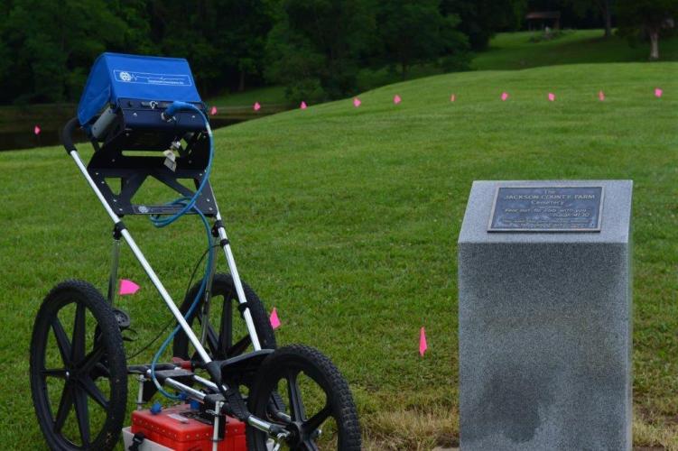
The Ground Penetrating Radar system, seen here, helped to map out the grassy knoll of what is believed to be the Jackson County Farm Cemetery.
Faith Walker, the curator of the Great Bend Museum in Ravenswood, West Virginia, sought to recognize and preserve the history of Jackson County, West Virginia's burial place of residents who were buried on the county farm property, a publicly funded residence that supported people in need.
To identify that this burial place existed, she needed the help of someone who could utilize Ground Penetrating Radar (GPR), which is how she discovered Issam Khoury, associate professor in Ohio University’s Department of Civil and Environmental Engineering.
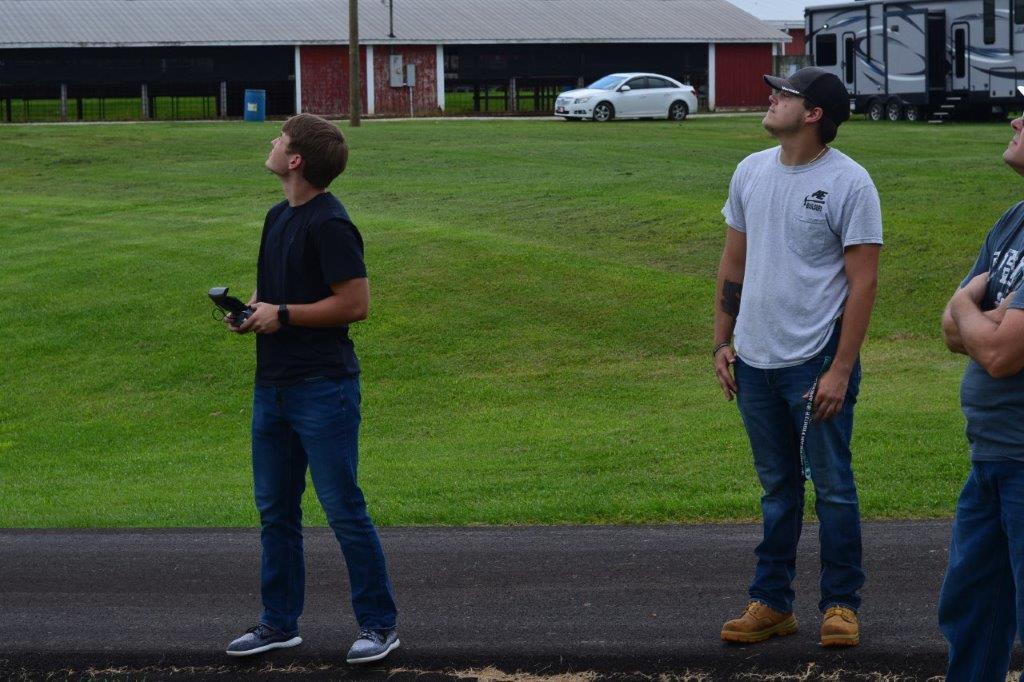
Khoury was willing to dedicate his time and knowledge, alongside Joshua Jordan, operations manager for the Ohio Research Institute for Transportation and the Environment, and students Ben Goodman and Andy Doczi, to map out the area that was suspected to be a grave site. Together they worked to map out the grass knoll which today is located near the stage at the Jackson County Fairgrounds.
First the team conducted a site review to determine their area of focus, which was a 60-foot by 150-foot grid covering the upper portion of the hill. Then they mapped out a grid to ensure an accurate survey of the land. From there, the GPR was used throughout the grid to read the ground’s density and identify obstructions.
“We decided to use our GPR system to ‘look’ through the surface of the grass and our drone to give us an overview of the site. GPR technology works by sending a tiny pulse of energy into a material via an antenna. An integrated computer records the strength and time required for the return of any reflected signals. Subsurface variations will create reflections that are picked up by the system and stored on digital media,” Khoury said.
Using the data collected detailing the underground landscape and views of the external surface, the team planned to stitch together the images to create a more complete picture of their findings.
“My role on the Jackson County grave project was to pilot a drone to take pictures of the site. We used those pictures to create a 3D model of the site,” Goodman said.
The goal was to collect data and ultimately model the site for further analysis. If this survey discovers that the site is a former burial site, then the team will return to continue their research to identify the parameters of the site.
Khoury’s team was pivotal in a larger project conducted by Walker to determine not just where the grave site is, but who is actually buried at the site. She wants to ensure that those who were buried there are properly recognized and honored, and her hope is that the Ohio University team can help to uncover a piece of Jackson County, West Virginia history.